Coca-Cola built a water risk model covering every square kilometer on Earth. Then gave it away. Your plant's exposure is free to check, today.
Joe Rozza told this story on Build Perspectives, and it's the kind of thing that sticks with you.

Coca-Cola built a water risk model covering every square kilometer on Earth. Then gave it away. Your plant's exposure is free to check, today.
Joe Rozza told this story on Build Perspectives, and it's the kind of thing that sticks with you.
In the mid-2000s, Joe's team at Coca-Cola put the entire planet into a one-kilometer computational grid. Water stress, population growth, economic development, every IPCC climate model, extrapolated out to 2095. They needed to know which of their 1,000 plants in 200 countries would run into water trouble, and when.
Then they did something rare. They walked into leadership and said: we can't hold onto this. And they handed it to the World Resources Institute.
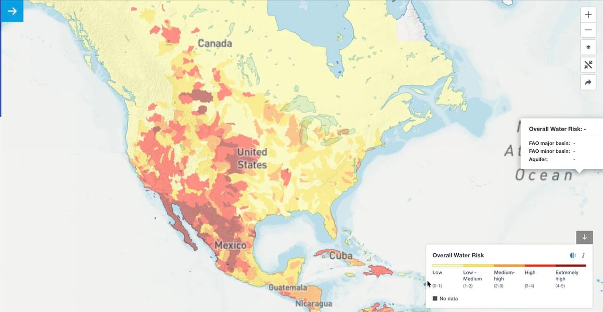
Today it's the Aqueduct platform. Free. Open license. Anyone can enter their coordinates and see current and future water stress for their plants and their supply chain.
Joe came with two warnings. Water stress isn't just a Southern California problem. He's watched it hit manufacturing in Ireland and Brazil through policy limits and infrastructure gaps, not drought. And he's seen what ignoring it costs: nine-figure plants sitting fallow because the community or the government turned the water off.
Carbon shows up on your books. Water shows up at your gate.
Here's the bottom line: you can map your facility's water exposure in about twenty minutes. All you need is your plant coordinates and access to the free Aqueduct tool.
This isn't theoretical risk modeling. It's the same system Coca-Cola built to protect a thousand facilities across two hundred countries. And now it's available to anyone.
That's the whole assignment. Twenty minutes and your coordinates.
AI may level a bid in 20 minutes, but it can't yet take your place…
Read →Your rep can name every architect in the city and not one superintendent. That's a…
Read →Have you ever been named in a lawsuit, or sat through a deposition? Corey Zussman…
Read →Monthly perspectives on sales execution, product strategy, and what's actually moving the needle in building products. Free, no filler.